09:00 AM
Lichthof, Mainbuilding H, TU Berlin
10:00 AM
Lichthof

10:10 AM
Lichthof
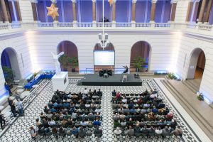
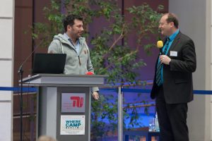
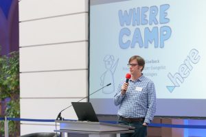
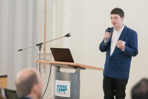
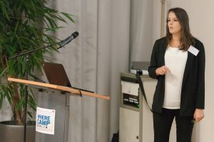
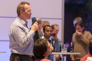
Opening of the 7th GeoIT Wherecamp Conference 2017
President of the Association for Geoinformatics, GeoIT and Navigation e.V.Download Presentation: 2-Opening-RolandWagner-geoit.org
10:20 AM
Lichthof
10:35 AM
Lichthof
10:40 AM
Track 1- Lichthof
11:00 AM
Track1-Lichthof
U-Space: Expanding Economy into the 3rd Dimension
FlyNex GmbHDownload Presentation: 4-USpaceExpandingEconomy into the 3rd Dimension drone mapping-Andreas Dunsch-FlyNex
 Drones promise a huge potential for future economic growth. They offer possibilities for companies in all sectors to expand their economic space into the third dimension. Most of the applications are not even developed. To boost and scale this development exploration of the very low air space under 150m is required. The so called U-Space needs solutions for its own including air space, ground bases environment, navigation, rules and regulations, weather, traffic, ... you name it. The creation of a functional U-Space will therefore not only lay the foundation for flying taxis but for expanding economy into the 3rd dimension overall.
11:00 AM
Track 3-Industrial-H2036
11:00 AM
Track 2-University-H2035
11:20 AM
Track1-Lichthof
11:20 AM
Track 2-University-H2035
3D City Models for Digital Maps and Navigation
IGG TU BerlinDownload Presentation: 8-3D City Models for Digital Maps and Navigation-Andreas Wichmann-TU Berlin
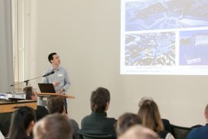 With the increasing technological advances and the ongoing digitization within society, the way how humans navigate in the real world has significantly changed. For centuries, analog maps were the predominant tool for human navigation. Nowadays, however, they are often replaced by digital maps which can visualize spatial information not only in 2D but also in 3D. These digital maps can be derived from digital 3D city models which represent the Earth’s surface and all related objects on it. Digital 3D building models, for example, are a major component of these 3D city models and have repeatedly shown their capabilities to serve as orientation for customers and to improve the positioning performance of GPS by mitigating multipath and non-line-of-sight effects in urban areas. Therefore, building models are of great interest for digital maps and navigation. In this talk, different approaches for the automatic reconstruction of 3D building models and their limitations will be presented. At first, a close look will be taken at two commonly implemented approaches. Afterward, an automatic reconstruction approach and some of its resulting building models will be presented. In contrast to many other strategies, this approach guarantees the topological correctness of the 3D building models and provides in addition to the geometric information also semantic information if required. The talk will conclude with an outlook on future research.
11:20 AM
Track 3-Industrial-H2036
11:40 AM
Track 2-University-H2035 => Track 3-Industrial-H2036
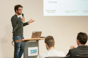
Consuming Open Data for Highly Customizable Route Planning
Heidelberg Institute for Geoinformation Technology, University of HeidelbergDownload Presentation: http://navigationtalks2017.geoit.org/wp-content/uploads/2017/09/9-Consuming-Open-Data-for-Highly-Customizable-Route-Planning-Timothy-Ellersiek-HeiGIT-UniHeidelberg.pdf
11:40 AM
Track 2-University-H2035
Geograpical Thinking in the digital Age
Alpen-Adria-Universität KlagenfurtDownload Presentation: 11-Geograpical Thinking in the digital Age-Mandl-Alpen-Adria-Universität Klagenfurt
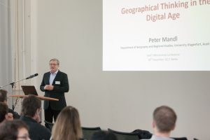 It is said that we live at the beginning of the “Digital Age” This should influence all areas of life, especially also geography as a science. In contrast geography, its concepts, theories and way of thinking also impacts diverse aspects of the Digital Age. Such interdependency are presented and discussed in this talk.
First there are spatial big data, which are the base for many empirical studies undertaken in geography since decades. Starting with quantitative as well as structured data many years ago nowadays also qualitative as well as unstructured data, like texts, images, videos etc. are available and used. The schemes and models of open, linked and user generated spatial data, which have been developed in geography or for OGC specifications, are very important sources for the structures, links and processing models for spatio-temporal data in the Digital Age. Secondly there are the spatio-temporal aspects in a digital world which is analysed and studied in geography since many years. Starting from the concepts by Thorsten Haegertstrand’s “Time Geography” many other like the “Models of Spatial Processes” by Arthur Getis and Barry Boots are described. These concepts can be the basis for spatio-temporal analytics and predictions in a modern data-based view of the world. Reflections from the GI-Science, like the „Language for Spatial Computing“ by Werner Kuhn or „The Language of Spatial Analysis“ by ESRI are the basis for the third aspect, the functions, which use the big data in concepts to contribute to problem solving in the Digital Age.
These three aspects of the Digital Age are consolidated in a final application for the management of wood fuel for power stations, discussed and criticised. It will be clear that the Digital World is ubiquitous today. It is very useful as a modern pragmatic information tool if it is applied correctly and critically. In this talk it is shown and suggested what “geographical thinking” can contribute to the practice of the Digital Age.
It is said that we live at the beginning of the “Digital Age” This should influence all areas of life, especially also geography as a science. In contrast geography, its concepts, theories and way of thinking also impacts diverse aspects of the Digital Age. Such interdependency are presented and discussed in this talk.
First there are spatial big data, which are the base for many empirical studies undertaken in geography since decades. Starting with quantitative as well as structured data many years ago nowadays also qualitative as well as unstructured data, like texts, images, videos etc. are available and used. The schemes and models of open, linked and user generated spatial data, which have been developed in geography or for OGC specifications, are very important sources for the structures, links and processing models for spatio-temporal data in the Digital Age. Secondly there are the spatio-temporal aspects in a digital world which is analysed and studied in geography since many years. Starting from the concepts by Thorsten Haegertstrand’s “Time Geography” many other like the “Models of Spatial Processes” by Arthur Getis and Barry Boots are described. These concepts can be the basis for spatio-temporal analytics and predictions in a modern data-based view of the world. Reflections from the GI-Science, like the „Language for Spatial Computing“ by Werner Kuhn or „The Language of Spatial Analysis“ by ESRI are the basis for the third aspect, the functions, which use the big data in concepts to contribute to problem solving in the Digital Age.
These three aspects of the Digital Age are consolidated in a final application for the management of wood fuel for power stations, discussed and criticised. It will be clear that the Digital World is ubiquitous today. It is very useful as a modern pragmatic information tool if it is applied correctly and critically. In this talk it is shown and suggested what “geographical thinking” can contribute to the practice of the Digital Age.12:00 PM
Lichthof
01:00 PM
Track1-Lichthof
Galileo, enhanced location performances for better apps
Market Development, EU GNSS AgencyDownload Presentation: 13-GSA Wherecamp 2017
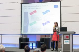 GNSS-based smartphones are expected to peak a worldwide installed base of 6 billion of units by the end of 2018 and practically all newly commercialised smartphones come with multi-constellation GNSS capabilities. Does it mean we are at the end of innovation around location technologies? The answer is no! Innovation around the development of location-aware applications is far from being exhausted and many technology developments in LBS are indeed centred on GNSS. Among them, Galileo – the EU Global Satellite Navigation System- is bringing enhanced performances for Location Based Services in mass market and IoT applications.
 01:00 PM
Track 2-University-H2035
Pop up Parklets! The role of technology in city-making
by DI Juan Carlos Carvajal Bermúdez
AIT Austrian Institute of Technology GmbHDownload Presentation: 14-Pop up parklets-Juan Carlos Carvajal-Institute of Technology
 Over the last few years, informal interventions spontaneously initiated by citizens have become increasingly popular. “Guerrilla”, “tactical”, “pop-up” and “DIY” urbanism are some of the terms coined to describe this trend. Short-term and low-cost constructions offer people the opportunity to shape their environment for their own needs, and eventually lay the groundwork for long-term transformations. Additionally, temporary interventions create nodes of social interaction and interchange at the neighborhood level. The potential of such interventions to create vibrant streets and neighborhoods has been already recognized by city administrations. For example, the city of Vienna has authorized the installation of parklets in many of the city’s parking places. There are, however, some limitations that should be taken into consideration when installing parklets. The understanding of such limitations can be simplified using open data and network technologies. This, unlike neogeography, is not so much about mapping shared interests but rather about visualizing the possibilities available in urban spaces. By allowing people to explore their urban space with a whole new filter, namely that of opportunities to intervene and create playful experiences in the city, it is possible to encourage citizens to become active in their neighborhoods and start transformation processes at the local level. Potential maps make it possible to condense intricate sets of regulations in a simple web-based cartography that uses basic visual elements to inform citizens about the possibilities and limitations for activities in public spaces. By superimposing and combining layers of information regarding parking spaces, hydrants, load zones, bicycle parking racks, reserved parking spaces, etc., it is possible to identify and highlight potential places for temporary interventions, such as parklets. This significantly reduces the effort needed by citizens to become active in public spaces and it is, at the same time, an invitation to make use of the possibilities that the city offers them, even if these are limited. The parklet potential map works as a catalyst for change in the city. It offers an understanding of urban space that would otherwise remain difficult to obtain by citizens, therefore paving the way for temporary (as well as potentially long-term) participation in urban transformations.
 01:20 PM
Track1-Lichthof
01:20 PM
Track 2-University-H2035
OpenGeoEdu
Universität Rostock Agrar- und Umweltwissenschaftliche FakultätProfessur für Geodäsie und Geoinformatik (GG)
Download Presentation: 17-OpenGeoEdu -Matthias Hinz-University of Rostock
 Promoting the use of Open Data facilitates more attractive conditions and practical relevance of research and education. OpenGeoEdu aims to prepare Open (Geo-)Data for education and science and to provide open access to cost-free data without restrictions. The use of Open Data will be taught with best practice examples from Geospatial Science and Technology that are conveyed in the form of e-learning lessons and Massive Open Online Courses (MOOCs). This talk will summarize the current state of the project, which just started in Summer 2017, and discuss its concepts and implementation. We present an online-platform for searching Open Data portals and Geodatainfrastructures and describe our prospective e-learning environment.
01:20 PM
Track 3-Industrial-H2036
The Status Quo of Smartphone Localization Methods – How a unified localization platform solves the fragmentation issue for indoor and outdoor navigation (a MOVIA project)
CTO and Founder of BeaconInside GmbHDownload Presentation: 18-Seamless Smartphone Localization-Cornelius Rabsch-BeaconInside
 The goal of the MOVIA research network is to foster the development of seamless navigation solutions. This talk gives an introduction about the status quo of smartphone localization and tracking methods and their application scenarios in indoor and outdoor environments. A concept for an interoperable and unified localization platform will be presented to solve existing fragmentation problems.
01:40 PM
Track1-Lichthof
Developing content for the new Google Earth
by Patrick Mast
Ubilabs GmbHDownload Presentation:19-Developing content for the new Google Earth-Patrick Mast-Ubilabs
 Earlier this year, Google has released a new version of Google Earth for web and mobile. One of Google Earth’s exciting new features is Voyager – a platform for stories around the globe. With Voyager, Google Earth not only takes you to your desired destination, but immerses you into a global adventure where there’s a lot to do, learn, and explore. For the past year, Ubilabs has been supporting Google in the designing, production and processing of this content. Coming up with unique approaches to storytelling and translating these ideas to Voyager’s functional and visual features has been a challenging experience. Among the content is an interactive special for the 2017 solar eclipse, a series of stories about the Brazilian rainforest, and adaptations of existing Google content like Treks and Streetview Collections. In this presentation we talk about our experiences of developing Voyager stories: the need for new storytelling approaches, technical challenges, and working on a all new product.
01:40 PM
Track 2-University-H2035
FoxyFoodDelivery
Travelling and Mobility R&D team, Lab Director, Université de GenèveDownload Presentation: 20_FoxyFoodDelivery-Michel Deriaz-University of Geneva
 FoxyFoodDelivery is a service allowing to order food from several different restaurants with reduced delivery costs. The innovation relies on a multi-objective optimization algorithm able to mutualise the different neighbouring orders and to plan the tasks in an optimal way. Restaurants increases their margin, deliverymen have more flexibility in working hours, final clients have more choices for lower prices.
01:40 PM
Track 3-Industrial-H2036
02:00 PM
Track1-Lichthof
The New Era of Location Tracking
CEO and Founder of CrowdlocDownload Presentation: 22-The New Era of Location Tracking-Ludovic Privat-CROWDLOC
 Asset tracking with GPS has been around for 15 years, but with its high power consumption, short autonomy and high cost, the traditional GPS and cellular combination is not relevant for a lot of today use cases in IoT.
Even new options such as GPS and LPWAN (i.e. Sigfox or LoRa) associations are not perfectly playing the part for a number of use cases where size and battery consumption matter. Then comes a new range of players, B2C startups such as Tile, TrackR, Chipolo and Wistiki that produce and sell Bluetooth LE tags to attach to the assets that needs to be located. These companies mutualize the service so that each consumer is geolocating the assets of all the others. Bluetooth LE technology has the obvious advantage to cost a lot less and to require far less power than the others while being embedded in 99% of smartphones. However, this technology approach leads to a new obstacle, which is to build a wide enough community. Because Tile, TrackR and others do it by selling hardware, the process is very slow. And in the meantime their offer is incomplete and doesn’t fully satisfy the consumers or needs. To answer these market requirements CROWDLOC imagined a different approach. Producing only a software solution in a B2B business model, CROWDLOC is building its community by implementing its SDK in the mobile applications of its partners. The CROWDLOC Alliance formed by this community can then geolocates 24/7 the assets of all its members, using the signal of Bluetooth tags and Bluetooth-enabled devices.
(CROWDLOC technology is currently in production for Android phones and the iOS version of our SDK will be released before Where Camp 2017). Our presentation will focus on the history of location tracking, the pros and cons of each technology (cost, power consumption, size, accuracy, indoor/outdoor) and the wide market opportunity (B2C & B2B) offered by drastically lowering the cost of location tracking.
Asset tracking with GPS has been around for 15 years, but with its high power consumption, short autonomy and high cost, the traditional GPS and cellular combination is not relevant for a lot of today use cases in IoT.
Even new options such as GPS and LPWAN (i.e. Sigfox or LoRa) associations are not perfectly playing the part for a number of use cases where size and battery consumption matter. Then comes a new range of players, B2C startups such as Tile, TrackR, Chipolo and Wistiki that produce and sell Bluetooth LE tags to attach to the assets that needs to be located. These companies mutualize the service so that each consumer is geolocating the assets of all the others. Bluetooth LE technology has the obvious advantage to cost a lot less and to require far less power than the others while being embedded in 99% of smartphones. However, this technology approach leads to a new obstacle, which is to build a wide enough community. Because Tile, TrackR and others do it by selling hardware, the process is very slow. And in the meantime their offer is incomplete and doesn’t fully satisfy the consumers or needs. To answer these market requirements CROWDLOC imagined a different approach. Producing only a software solution in a B2B business model, CROWDLOC is building its community by implementing its SDK in the mobile applications of its partners. The CROWDLOC Alliance formed by this community can then geolocates 24/7 the assets of all its members, using the signal of Bluetooth tags and Bluetooth-enabled devices.
(CROWDLOC technology is currently in production for Android phones and the iOS version of our SDK will be released before Where Camp 2017). Our presentation will focus on the history of location tracking, the pros and cons of each technology (cost, power consumption, size, accuracy, indoor/outdoor) and the wide market opportunity (B2C & B2B) offered by drastically lowering the cost of location tracking.02:00 PM
Track 2-University-H2035
The Where in Citizen Science
Institute for Geoinformatics, University of MünsterDownload Presentation:23-The where in citizen science-Thomas Bartoschek-Uni Münster
 In recent years Citizen Science became a rapidly growing field although it is more than 100 years old. Due to emerging technologies, internet, smartphones and low-cost sensors more and more people get involved in citizen science projects and contribute with questions, data, local knowledge or publications. Similarly to other fields more or less of 80% of the citizen science projects have a spatial component and present data and results on maps, while different technologies may be used for data collection or interpretation. Usability and user experience play a major role in the success of a project and seem to make a difference in the levels of participation. This talk gives a overview about the role of geoinformatics in citizen science and shows best practice from the senseBox project and its openSenseMap.
02:00 PM
Track 3 - H2036
03:00 PM
03:30 PM
Track3-H2036
General Assemby of the Association for Geoinformatics, GeoIT and Navigation e.V.
by Dr.-Ing. Johannes Ludwig , Julia Lebert , Prof. Dr. Thomas Blaschke , Cornelius Rabsch , Dr. Lukasz Bonenberg , Prof. Dr. Matthias Möller , Prof. Dr.-Ing. Martin Kada , Justyna Redelkiewicz , Dr. Matthias Jöst , Richard Süselbeck ,
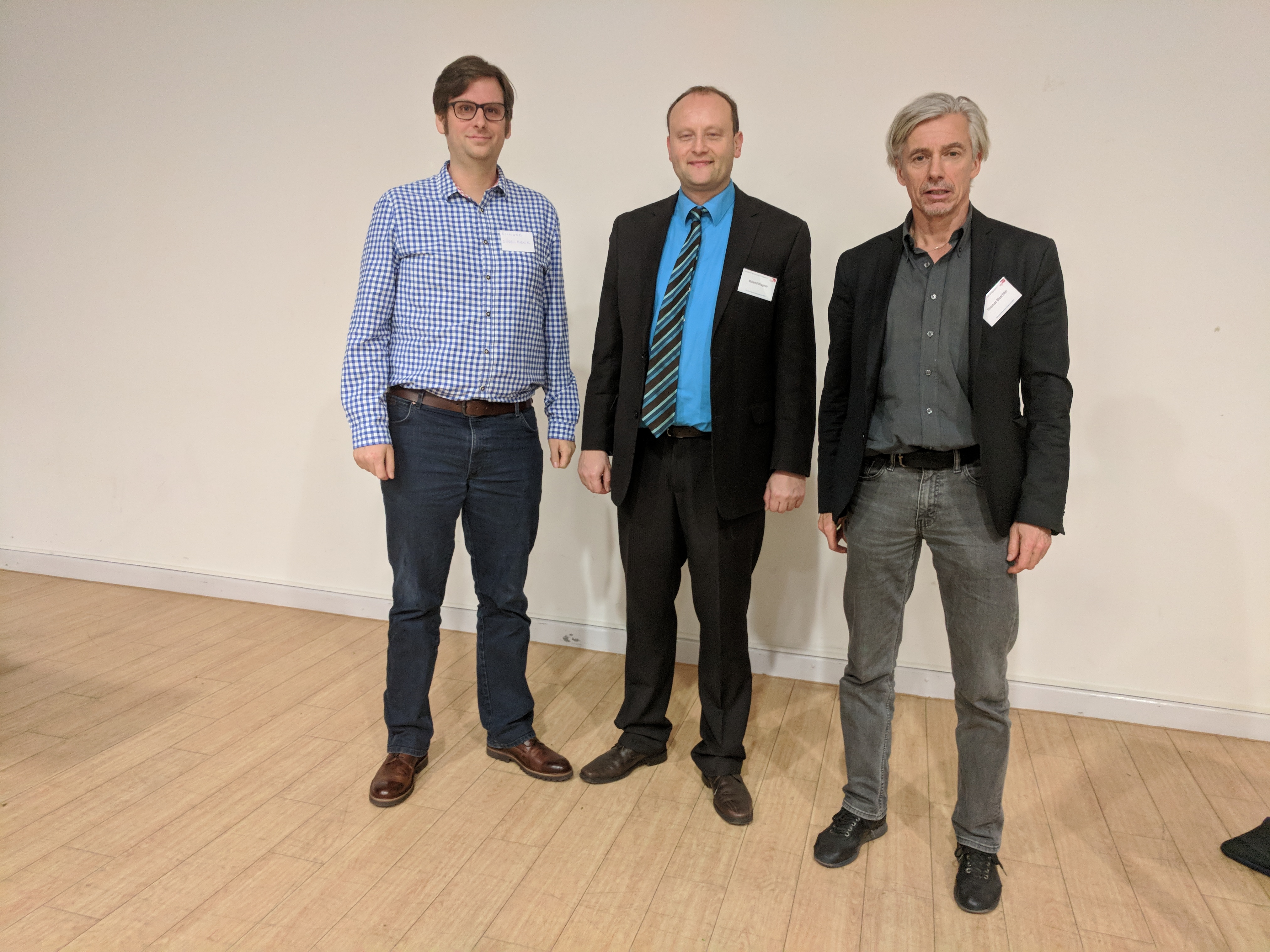
Richard Süselbeck (new Treasurer), Prof. Dr. Roland Wagner (President) and Prof. Dr. Thomas Blaschke (Vice President)
Invitation to the Assembly of Members 2017: 30th November @ Wherecamp 15:30 - 16:30 h Dear GeoIT.org Member , you are invited as a member to our Assembly of Members to get informed, to vote a new treasurer, to plan 2018 with our actvities like GeoIT GeoMonday or GeoIT Perspectives and also to bring in your ideas and initiatives. Jan Nowak switched into another domain and position and therefore the Board of Management needs a new treasurer. An overall voting of a new board is not neccessary this time. Topics TOP 1: Welcome of members by President TOP 2: Report of the Board of Management TOP 3: Voting of a new treasurer TOP 4: Planing of 2018 with- New Projects for the association and its members?
- GeoIT GeoMondays and
- GeoIT Perspectives with different Locations hosted by membersTOP 5: Miscellaneous
03:30 PM
Track1-Lichthof
Big data for indoor crowd mobility
CRO indoo.rs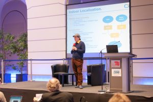 Current indoor localization solutions are predominantly used for navigation and simple user analytics. However, as the standard and availability of mobile sensors increase, new possibilities arise to generate new kinds of high quality localized data. Moreover, IoT sensing infrastructure and geographic information systems are becoming more common. Separately these data streams already enable many novel solutions, but in combination they may help uncover new profound knowledge. In this work, we outline how we bring big data from the crowd of navigating users together with building information data in order to analyze and predict human actions in indoor environments. For this purpose, multi-source data are acquired, assessed for usefulness, and processed in a big data pipeline. Having multiple constraints from different sources allows to remove systematic differences, reject outliers, and to suppress noise. Machine learning and artificial intelligence are employed to compress and summarize the data. Visualizing these data then helps to interpret how buildings are used. Furthermore, the data can be utilized to train realistic mobility models that predict how people will interact with each other and their environment. Together the combination of new data and techniques dramatically increases what can be learned about a building.
03:30 PM
Track 2-University-H2035
A German study about Research Software Engineers (RSEs) – The people writing software for Science
Helmholtz Centre PotsdamGFZ German Research Centre for Geosciences
Download Presentation: 26-A-German-study-about-Research-Software-Engineers-RSEs-The-people-writing-software-for-Science-Martin-Hammitzsch-GFZ
Simon Hettrick, Stephan Janosch and Olivier Philippe
03:50 PM
Track1-Lichthof
Indoor GPS-System
NAiSE GmbHDownload Presentation: 28-Indoor GPS System-Jens Heinrich-NAiSE GmbH
 There is no solution for indoor navigation, that has established itself as a market standard. This mostly due to the fact, that the used technologies are either too comlpicated for the users or simply just don't work reiliably.
We at NAiSE developed a system that makes indoor navigation possible via real GPS signals. You get absolute positioning inside of a buidling and don't need further installations on your device, as long as it has a GPS receiver. This way you have a seamless tranistion from inside to outside, which opens up many possibilities.
There is no solution for indoor navigation, that has established itself as a market standard. This mostly due to the fact, that the used technologies are either too comlpicated for the users or simply just don't work reiliably.
We at NAiSE developed a system that makes indoor navigation possible via real GPS signals. You get absolute positioning inside of a buidling and don't need further installations on your device, as long as it has a GPS receiver. This way you have a seamless tranistion from inside to outside, which opens up many possibilities.03:50 PM
Track 2-University-H2035
Standardized Localization Interface
by Ivan Azcarate , Filip Lemic ,
Telecommunication Networks Group of Berlin University of TechnologyDownload Presentation: 29-Standarized Localization Interface - Filip Lemic - Ivan Azcarate - TU Berlin
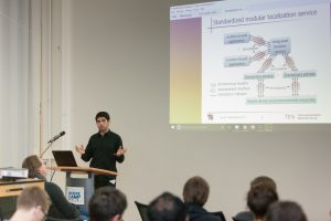 Location-based applications are currently proprietary to service that is providing location information, hence they require significant modifications to be able to run with another localization service. To address this pitfall, a recently proposed middle-ware localization service architecture allows seamless provisioning of location information based on applications’ requirements, irregardless of the underlying source of location information. A unified style of interaction between the application and the middle-ware service is supported by the Standardized Localization Interface (SLI). In this work, we first overview the main interaction primitives of the SLI. We follow by demonstrating its benefits using location-enhanced horizontal WiFi handover as an example application.
04:10 PM
Track1-Lichthof
Bringing Augmented Reality Indoor Navigation to everyone’s phone with Google Tango and ARCore
by Till Krempel
Cologne Intelligence Mobile Minds GmbH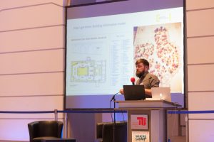 Over the last couple of years, a variety of solutions for realizing augmented user interfaces on mobile devices has evolved. Beginning with mobile augmented reality frameworks like Metaio, Vuforia or Wikitude technology has evolved to Tango devices with extra hardware components and back to purely software driven solutions like ARCore and arKit. Tango (formerly known as „Project Tango“) by the Google Advanced Technology and Projects team introduced a hardware component for a next generation of android smartphones, that claims new use cases by the use of additional sensors, multiple cameras and a powerful software library. The consequences of Tango as an enabling technology are more evolved software only solutions like ARCore, that bring a similar precision to everyone’s phone, no extra hardware needed. As the physical environment of the device gets quantifiable with centimeter grade precision, the augmentations can be presented at a real location in reality’s three-dimensional space and truly embed into their surroundings. The manifold new possibilities are illustrated using the use case of indoor navigation. Indoor Positioning with a with a precision improved by multiple magnitudes, as well as Tango’s area learning and ARCore’s environment understanding features, offer an innovative alternative to existing indoor navigation solutions and makes their infrastructural preconditions (iBeacon grids, Wi-Fi) obsolete. On the long run services like the Visual Positioning Service (VPS) announced by Google could be the successor of the everyday present Global Positioning Service (GPS). The session illustrates these developments with the example of a classic two-dimensional indoor map navigation and an augmented reality user interface, where routes embed more seamlessly into reality. While the use case of augmented reality is not limited to indoor navigation, it helps to get a good understanding of the differences between Tango’s and ARCore’s capabilities and their implications for the future of mobile augmented reality and indoor positioning technology on a global scale.
04:10 PM
Track 2-University-H2035
PARADISE – Privacy-enhancing Technologies in a Doping Control Use-Case
by Dr. Denis Giffeler , Sebastian Zickau ,
Technische Universität Berlin | Telekom Innovation LaboratoriesTelecommunication Systems Service-centric Networking (SNET)
Download Presentation: 31-PARADISE – Privacy-enhancing Technologies in a Doping Control Use-Case_Prof_Mund
 PARADISE is a multidisciplinary project that seeks to promote and guarantee the overall privacy, security, and usability of the anti-doping coordination platform. At the same time, the PARADISE system also aims to improve the quality of doping controls while retaining their reliability and unpredictability. Back in 2012, Jonas Plass —former 400m runner and German national track and field team member— came up with the notion of developing an additional system that utilized location-based services- called »eves« to complement the already existing »ADAMS«. Mr. Plass and Dr. Denis Giffeler (gekko mbH) thus designed a fully detailed concept, which would lead them to set up a research project comprising expertise from a wide array of backgrounds. Working alongside firms and institutions such as Fraunhofer Gesellschaft’s institutes FIT and AISEC, Technical University Berlin, the Independent Centre for Privacy, Schleswig Holstein, and Uniscon GmbH, they expanded the original idea developing a prototype which integrates »eves« as a capability that athletes can voluntarily utilize. In 2016, PARADISE was granted funding by the German government within a Data Privacy Call of the Ministry of Education and Research to further develop their project. Hence, the key topics PARADISE addresses are control quality, data privacy, usability and security. In sum, PARADISE addresses some of the main criticism made about the current control system and improves athletes’ acceptance. To begin with, athletes carry a GPS and GSM-equipped wearable (the device called »eves«). Once a DCO has received a control order for an athlete, the DCO can use the PARADISE platform to request the athlete’s current whereabouts. Athletes still have to introduce additional data into ADAMS, but instead of entering exact addresses, it will now be enough for them to indicate the city where they are to be found. This increases privacy for the athletes while simultaneously allowing DCO to plan their travels in advance. DCO can thus find out the exact location of the athletes they need to control via »eves« on the day the actual control will take place. The idea is to make the use of »eves« a choice for athletes. Those athletes who are not comfortable with carrying the device will continue registering their whereabouts just like they had been doing with ADAMS. The use of established localization-based technologies, GPS, and GSM, makes the system potentially usable worldwide. Overall, the underlying principles of PARADISE are in agreement with Europe’s General Data Protection Regulation, fostering both data minimization and respect for the principle of dedicated use. Indeed, because of the protocolling system PARADISE implements, both athletes and DCO achieve full transparency. While DCO can obtain an overview of past actions within the system, athletes whose control has already been successfully completed will similarly gain insights about any requests of their personal position. These are qualities that enable athletes and DCO to take the right to information to the next level.
04:30 PM
05:00 PM
Track1-Lichthof
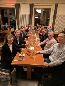
06:00 PM
Schleusenkrug, Müller-Breslau-Straße 1, 10623 Berlin
09:00 AM
GeoIT Labs
Steinstraße 12
10119 Berlin Mitte